


- About us
-
Project/Schedule
Downloads
Training & Suggestions
- Project/Programme
-
Other Offices
Divisional/Upazila Offices
Ministry/Division & Department
- E-Service
- Gallery
-
Contact
Office Contact
Communication Map
- Opinion
মেনু নির্বাচন করুন
- About us
-
Project/Schedule
Downloads
Training & Suggestions
-
Project/Programme
District Based Women Computer Training Scheme Scheme (64 Districts)-
Information APA: Empowerment of Women Project through Information Communication Technology (Phase 2)- to build Digital Bangladesh
Women entrepreneurs development project for economic empowerment at grass root level
-
Other Offices
Divisional/Upazila Offices
Ministry/Division & Department
- E-Service
- Gallery
-
Contact
Office Contact
Communication Map
- Opinion
Main Comtent Skiped
Image
Title
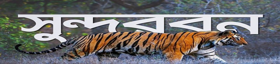
Sundarbans.
Details
Sundarbans:
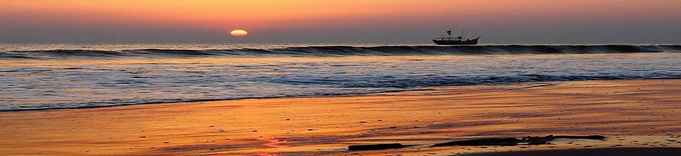
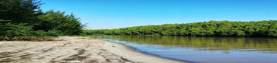
Sundarbans is a vast forest area on the coast of the Bay of Bengal which is one of the natural wonders of the world. Located in the delta of Padma, Meghna and the Brahmaputra river basin, this unique forest area is spread over Khulna, Satkhira, Bagerhat, Patuakhali and Barguna districts of Bangladesh.
As one of the largest mangrove forests of the salt sea coast, the Sundarbans is the largest intact forest in the world. Bangladesh, which covers an area of 1.5 sq km, has 5 sq km in Bangladesh. The Sundarbans was recognized as a UNESCO World Heritage Site in 7 CE.
Its Bangladesh and Indian parts are in fact adjacent to the same uninhabited land, but are listed on UNESCO's World Heritage list under different names; Named "Sundarbans" and "Sundarbans National Parks" respectively.
The Sundarbans are enclosed by a network of marine streams, mud chars and mangrove forests, along with salinity of mangrove forests. About 1.5 percent of the total forest area, that is, 1,5 square kilometers, covers rivers, creeks, wetlands with bills.
In addition to the famous Royal Bengal Tiger in the forest, the forest is known as home to numerous species of birds, chitra, deer, crocodiles and snakes. According to the survey, there are 1 tiger and 5 chitra deer now in the Sundarbans area. On May 27, 2012, Sundarbans was recognized as the place of Ramsay.
Nomenclature:
In Bengal the meaning of the Sundarbans literally means beautiful forests or beautiful forests. The Sundarbans may have been named after the beautiful tree, which grows abundantly there. Other possible explanations might be that it was named after the "sea forest" or "moon-bound" (ancient aborigines). However, it is generally assumed that Sundarbans are named after the beautiful tree.
Geographical structure:
The satellite image shows the protected area of the forest. The car is surrounded by beautiful green landscapes, which are surrounded by light green fields of farming on the north, the city and rivers in blue.
One of the largest mangrove forests in the entire world, the Sundarbans have the most complex ecosystem in the Ganges basin. The two neighboring countries, the greater part of the Sundarbans (12%), are located in the southwest of Bangladesh.
Bay of the south; The border with the Baleshwar River in the east and the higher cultivating land in the north. Apart from the main streams of the upper Ulukalaya, the streams are heavily flooded by barren and lowlands.
The actual size of the area was estimated to be around 1.5 sq km. (20 years ago). At least the current volume is about one-third the size of the previous one. At present, the total land area is 5,3 sq km. (Baltut with an area of 12 sq km) and the rest of the catchment area, including rivers, creeks and canals, is 5.7 sq km. .
The rivers of the Sundarbans are the meeting ground of salt water and fresh water. So the fresh water from the Ganges, the middle of the salt water in the Bay of Bengal is the area. It is located in Satkhira, Khulna, Bagerhat and Patuakhali areas in Bangladesh. Sundarbans is located in the southwestern region of Bangladesh.
For thousands of years, the inter-stream flow along the Bay of Bengal has naturally formed a well-separated sedimentary stream. Its geographical structure is sub-island, with numerous streams and mud walls spread over the water and mud.
It also includes marginal grasslands, sand dunes, and islands that are higher than the average height of the seabed, which are covered by nets like canals, underground clay walls, sedimentary and mud deposits. The height of the Sundarbans from the sea level is 1.5 meters to 2.5 meters.
The biological elements play an important role here in the formation and marine diversity of marine matter. Diversified areas such as beaches, estuaries, permanent wetlands, mud pits, creeks, sand dunes, earthen ditches have been formed here. The mangrove plant plays a role in the formation of new land in the world. Again, intergovernmental plants play a vital role in the aquaculture process.
The presence of mangrove fauna creates an intricate physiological environment in endocrine mud pastures. Aptly holds the seed to create a horizontal subclass for the seed. The organization and evolution of anantavaliyari is controlled by a large number of plants. Stabilizes the structure of clumps, grasses and hogs, and unstructured polyester.
Plant diversity:
The major forest varieties of the Sundarbans include large quantities of beauties, geva, goran and keora. According to Prine's estimates published in 3, there are a total of 20 species and 4 species of plants. There have been significant changes in the mangrove species and their taxonomy following the report of the prairie. The nature of the vegetation has rarely been explored to account for these changes.
Compared to other non-island coastal mangrove forests and highland forests, there is a wide variation of plant life in the mangrove forests of Bangladesh. Rhizophoraceae is more important than the previous one. The variation in plant life cycle is explained by the effect of pure water and low salinity in the northeast, and on the drainage and sediment storage.
The Sundarbans are classified as a humid tropical forest that has grown on fine beaches, as well as the forests of Keora and other coastal shrubs.


Site was last updated:
2025-05-25 14:30:16
Planning and Implementation: Cabinet Division, A2I, BCC, DoICT and BASIS
Technical Assistance:
![]()
Developed By: